Through our experience and network in the UAV sector, WING LIFE is capable of implementing be- spoke solutions for your special projects.
Solving problems using UAV
WHAT’S IN OUR ARSENAL?
Drones
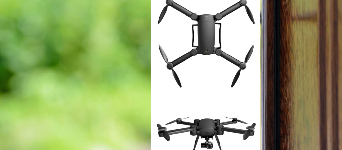
Drones are mainly classified into either being Multi-rotors or Fixed-wing. Multi-rotor drones function like a helicopter with vertical take-off and landing capabilities allowing for more manoeuvrability in tight spaces. They are optimal for use in relatively small to medium areas. They are also very useful for creating 3D models of structures due to their ability to take oblique images. Fixed wing drones are designed more like traditional airplanes. We use these drones to cover large areas. Depending on the accuracy, we can cover up to 20 km2 per day. All our drones are equipped with cutting edge sensors including: 40 MP RGB cameras, FLIR thermal cameras and air quality sensors. Different camera lenses are used for different applications, for example, when the requirement is to create 3D models of structures, a fish-eye lens is recommended * Custom payloads available upon request
GPS TECHNOLOGY
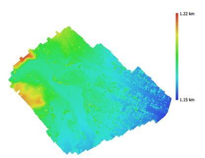
To ensure the accuracy of our outputs, WING LIFE integrates several tools and procedures into our workflow. With the use of a base station-rover combo, we set ground control points and check points. These are markers placed on the ground that are clearly visible from our drone images. Ground control points are integrated into the processing of the outputs to improve accuracy. Check points are used to independently validate the accuracy of the outputs. Our drones also have Real Time Kinematic (RTK), and Post Processing Kinematic (PPK) capabilities. RTK is a GPS correction technology technique that provides real-time corrections to location data when the survey drone is capturing photos of a site. PPK is another GPS correction technology technique that works to correct location data, except this is done after the drone data has been captured and uploaded. Using GPS correctional technology can improve data accuracy by 75%. Additionally, data acquisition can be performed much faster because of this technology.
Why choose us
novel approach...
PROPOSAL & PERMISSIONS
WING LIFE meets with the clients to de- termine the requirements of the project. Based on t he t ype of pr oject , accuracy, and size, we would draft a proposal. After that, an initial site survey is conducted, and all neces- sary permissions and paperwork are obtained.
PLANNING & SITEWORK
before any flight, WING LIFE have to con- sider metrics such as wind speed, lighting, visibility, temperature, accessibility, and physical obstructions. After choosing the right equipment for the job, a flight plan is generat ed. The flights are then conducted, and the data is collected and taken back for processing.
PROCESSING & SOFTWARE
The collected data is then processed on the cloud by super computers, dramatically decreasing the time required to generate your models. The appropriate software is then chosen and prepared for the client.
DELIVERY & TRAINING
The outputs and access to the software are then delivered to the client. At this point WING LIFE will tap into its ethos of customer success management. This means that one of our specialists will closely work with your team to ensure they are well trained and making the most possible use of the acquired data.